
Update: Marikina River hits 18M.
Metro Manila woke to steady sheets of rain Monday as the southwest monsoon or habagat, settled over Luzon. Pagasa warned that the current wet spell could last several days and worsen flood-prone areas across the capital.
Monsoon Pattern and Current Conditions
The weather bureau’s 5 a.m. bulletin pinned the day’s soaking on moist south-westerlies blowing in from the West Philippine Sea. Zambales, Bataan, and Occidental Mindoro are seeing the heaviest bursts, yet Metro Manila stays under frequent showers that can quickly swell streets and gutters. Moderate to strong winds add dangerous surf along western coasts.
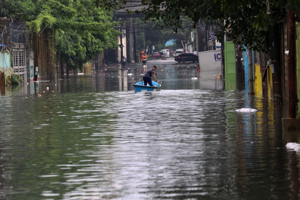
Impacts and Disruptions in Metro Manila
Government work and classes were halted city-wide starting 1 p.m. to keep commuters off waterlogged roads. Agencies delivering essential health, rescue, and other vital services remain operational.
Flood advisories from local disaster offices list knee-deep pooling in several low-lying districts. Motorists report slow traffic on EDSA and España despite round-the-clock pumping operations.
Low-Pressure Area Update (as of 12 p.m., July 21)
A weak weather disturbance east of Luzon is edging west-northwest. At 8 a.m. it sat about 950 kilometers east-northeast of Eastern Visayas near 15.0° N, 133.5° E. Pagasa now puts the odds of it becoming a tropical depression within 24 hours at a medium level. It’s still over open sea, yet its broad circulation keeps pumping moisture into the habagat soaking Luzon and the Visayas. Forecast tracks keep the system moving north-northwest and away from land through Tuesday. Keep an eye on official bulletins for any change in speed or strength.
Marikina River Alert Level Raised as Rains Continue
Marikina’s gauge hit 16 meters at 2:20 p.m., so the city raised the Second Alarm. Two siren blasts told riverside communities to leave early and head to evacuation centers. The First Alarm sounds at 15 meters and asks residents to pack essentials. A Third Alarm at 18 meters forces mandatory evacuation across all high-risk zones. Rescue crews are on standby and hotline 161 is open round the clock. Steady monsoon rain may push the river higher, so follow city updates and move to safety when instructed.
Marikina River Hits Third Alarm
At 10:08 p.m. on Monday, July 21, the Marikina River surged to 18 meters, crossing the highest threshold on the city’s flood gauge. Officials sounded three siren blasts and ordered forced evacuation for all riverside barangays. Rescue 161, police, and fire teams are moving door-to-door to clear low-lying streets before midnight high tide pushes levels even higher.
City shelters at Concepcion Integrated School, H. Bautista Elementary, and Nangka High are now open. Motorists should avoid the Riverbanks–Meralco stretch and use Marcos Highway or Sumulong Highway as alternate routes. Hotline 161 remains active for rescue requests. Stay tuned to the Marikina PIO page for hour-by-hour gauge readings and further instructions.